Welcome to Infrakit Knowledge Base
Search our knowledge base for answers or contact support@infrakit.com / +358 9 4257 9297
Infrakit FIELD
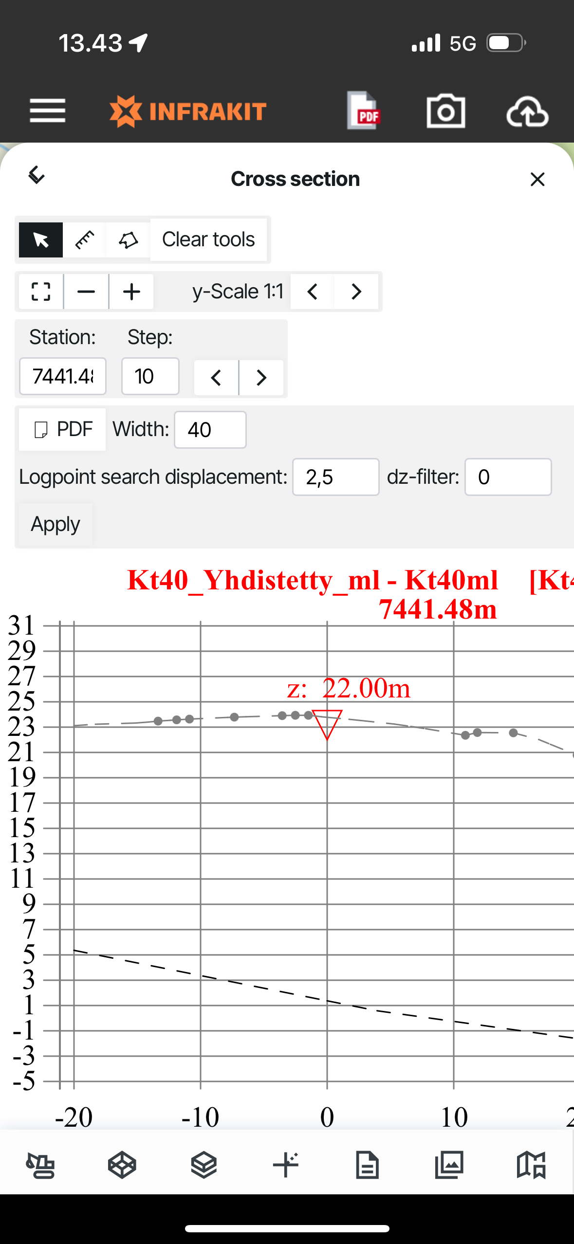
FIELD app - Visualizing cross-sections and measuring
In the FIELD app you can visualize the cross-sections from the data and measure.
Updated 3 weeks ago
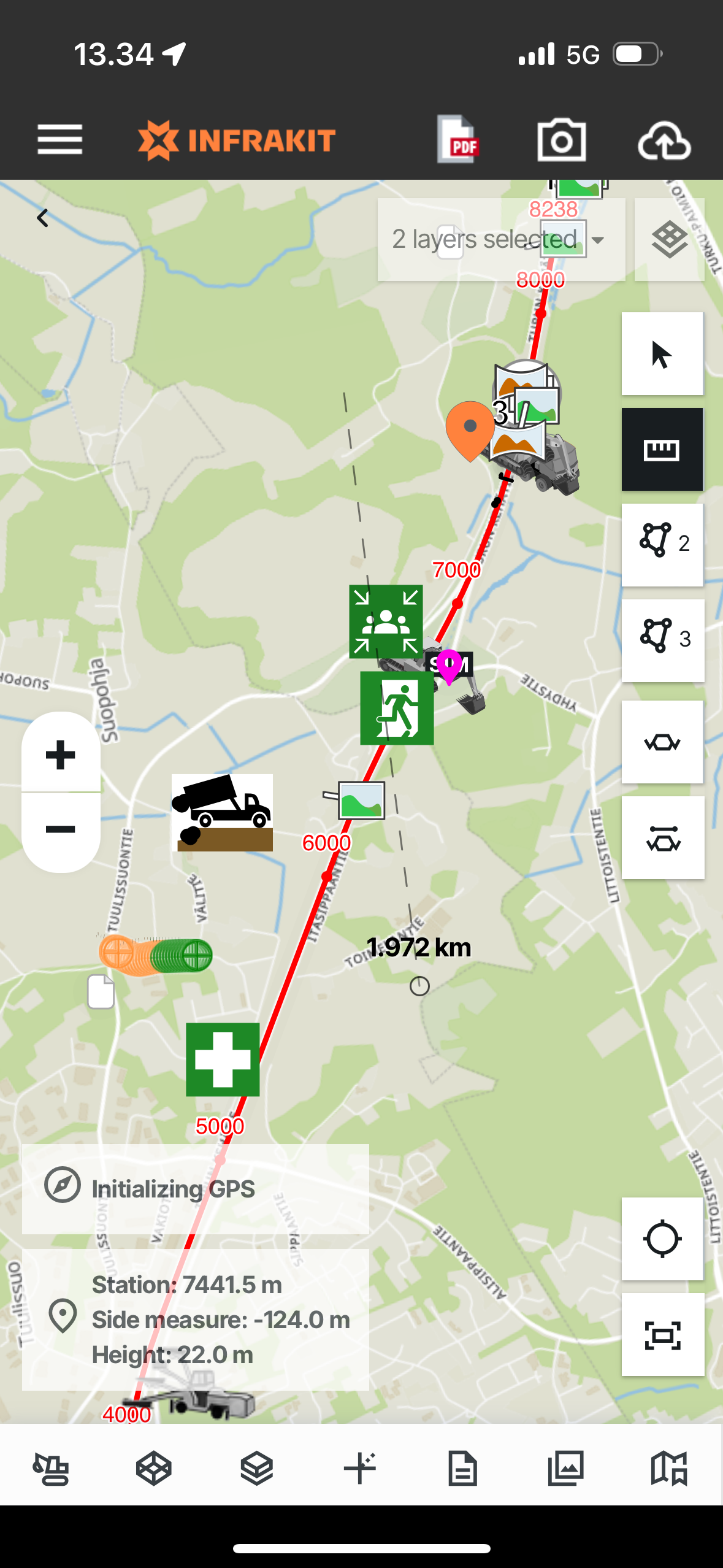
Once you open the app you'll see the map interface with buttons on the right-hand corner for measurements and cross sections.

Let's go through the buttons from top to bottom:
1. ARROW - When this button is selected you can normally interact and move on the map
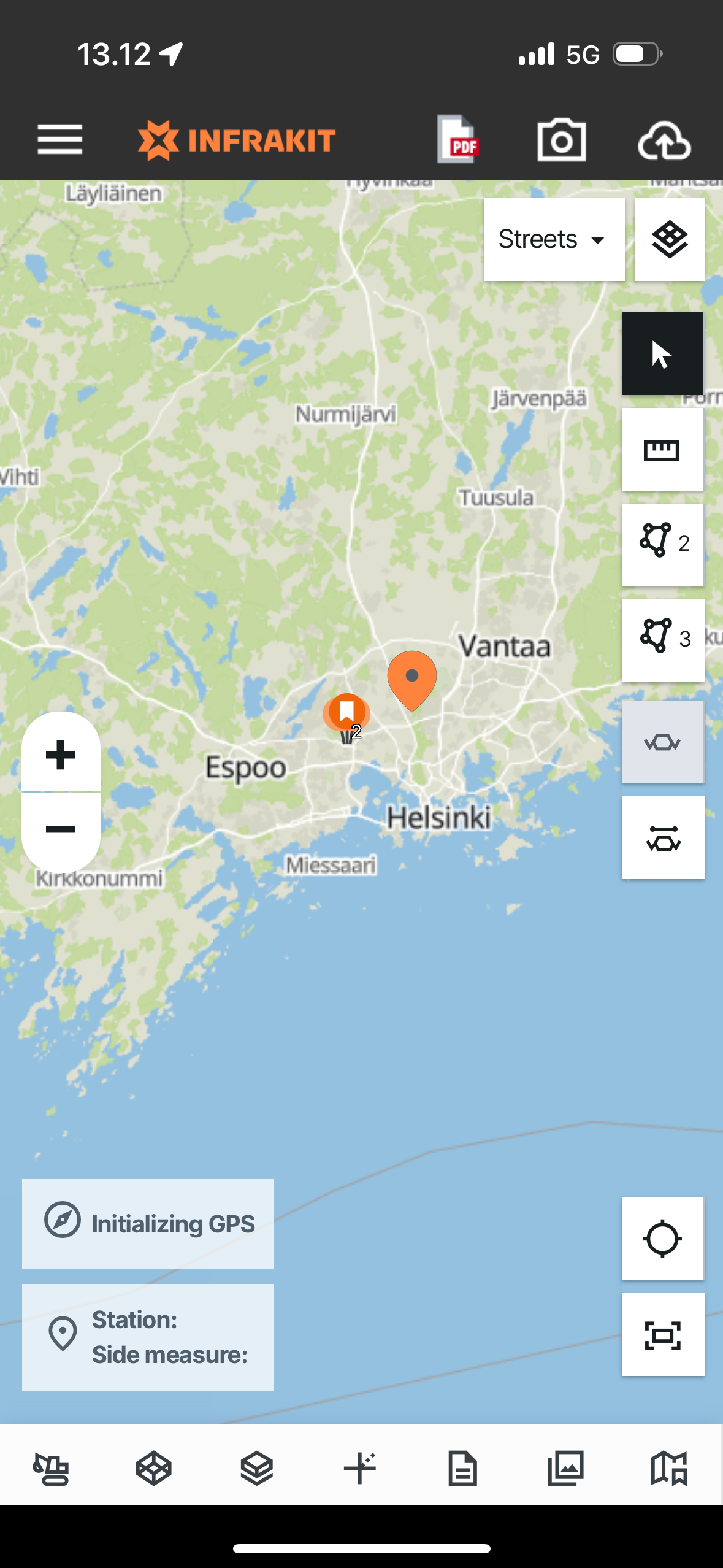
2. MEASURE - When this button is selected, you can perform direct measurements from point A to point B on the map by pressing the points
3. AREA MEASUREMENT - When this button is selected you can perform 2-dimensional area measurements on the map by pressing the points
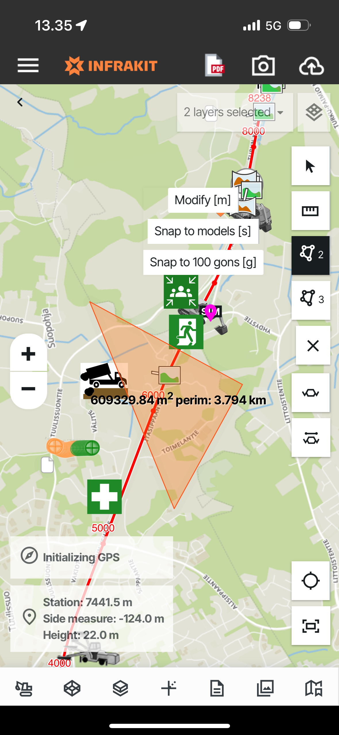
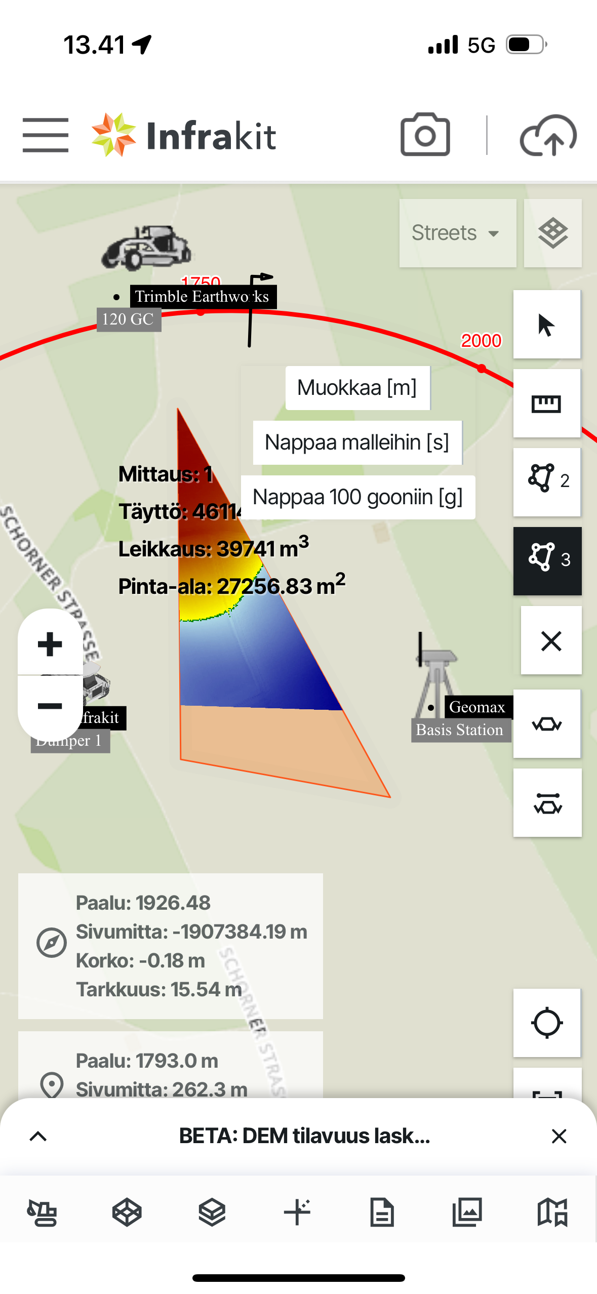
4. VOLUME MEASUREMENTS - When this button is selected you can perform 3-dimensional volume calculations on the map against selected DEM models by pressing points on the map
5. CROSS SECTION - When this button is selected you'll enter the cross-section tool where you can navigate between stations and perform measurements based on the data selected on the map
6. FREE CROSS SECTION - When this button is selected you can freely select a spot where to see the cross-section view
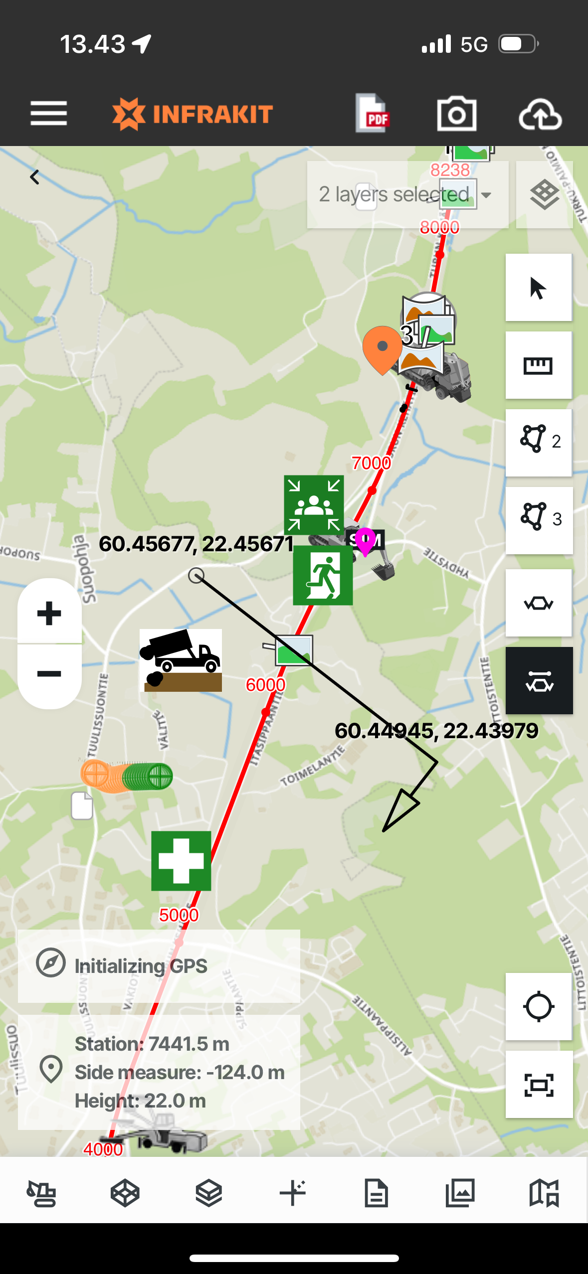
TIP: You can Snap measurements to models, 100gons and modify them - These buttons will show once you select the tool