Basic settings
In Basic settings you can:
- Select coordinate system
- Insert datum transformation grid file
- If your coordinate system uses grid correction
- Supported file format is sgf
- Upload file to folder structure and select it here
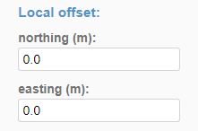
- Add local offset
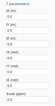
- Correct the coordinate system with 7-parameter transformation
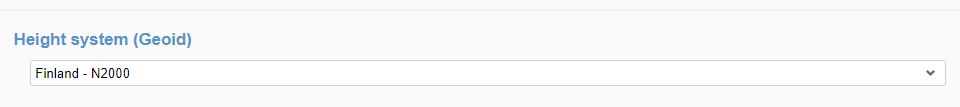
- Select project height system
- Affects for Infrakit Field app
- If your local height system is not available in the list, you can import ggf-file into project file space and select it to be used here
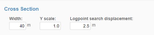
- Change the default settings of the cross section
- Width determines the default width of the cross section view
- Y-scale exaggerates height
- Logpoint search displacement determines how far from the cross section taken are as-builts visible in that cross section
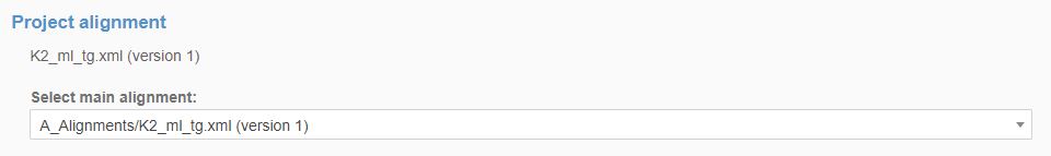
- Select project alignment
- Prompts as default in apps
- Calculates station for project equipment
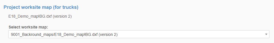
- Select work site map for Truck app
- Adds default drawing to shown in Truck app for drivers and in Trucks page for users
- Adds default drawing to shown in Truck app for drivers and in Trucks page for users
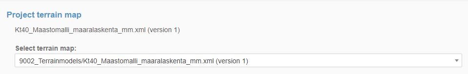
- Select project terrain map
- Show terrain in cross-section
- Show terrain in cross-section
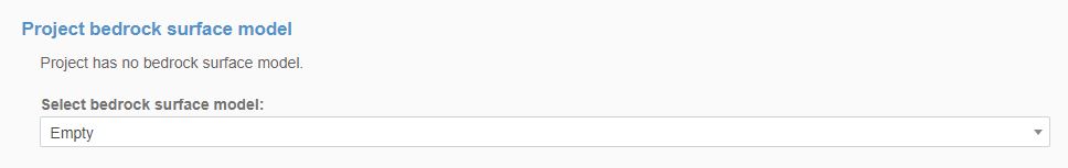
- Select project bedrock surface model
- Shows in cross section
- Shows in cross section
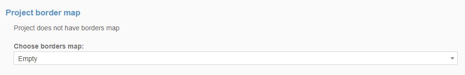
- Select project border map
- Visible in cross sections
- Visible in cross sections
- Add codes mapping file
- Code file containing project codes and descriptions
- Supported format is nfcl


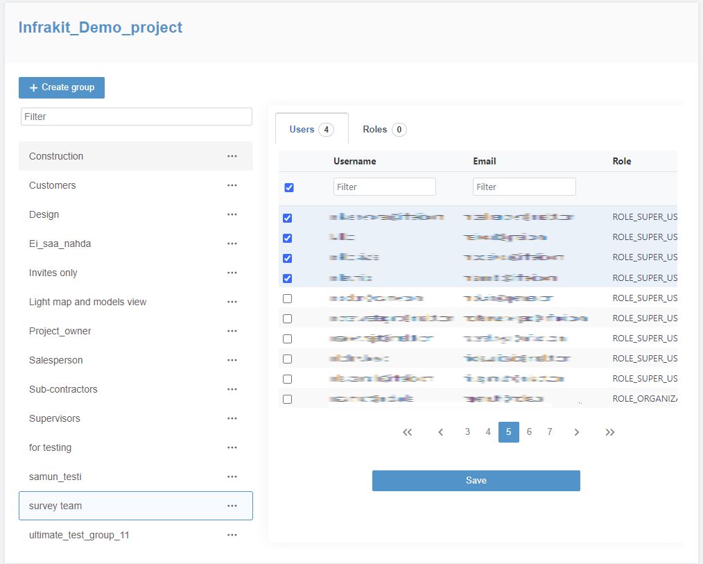
Groups
User groups are used for for example in Folder permissions and sending notifications to certain group
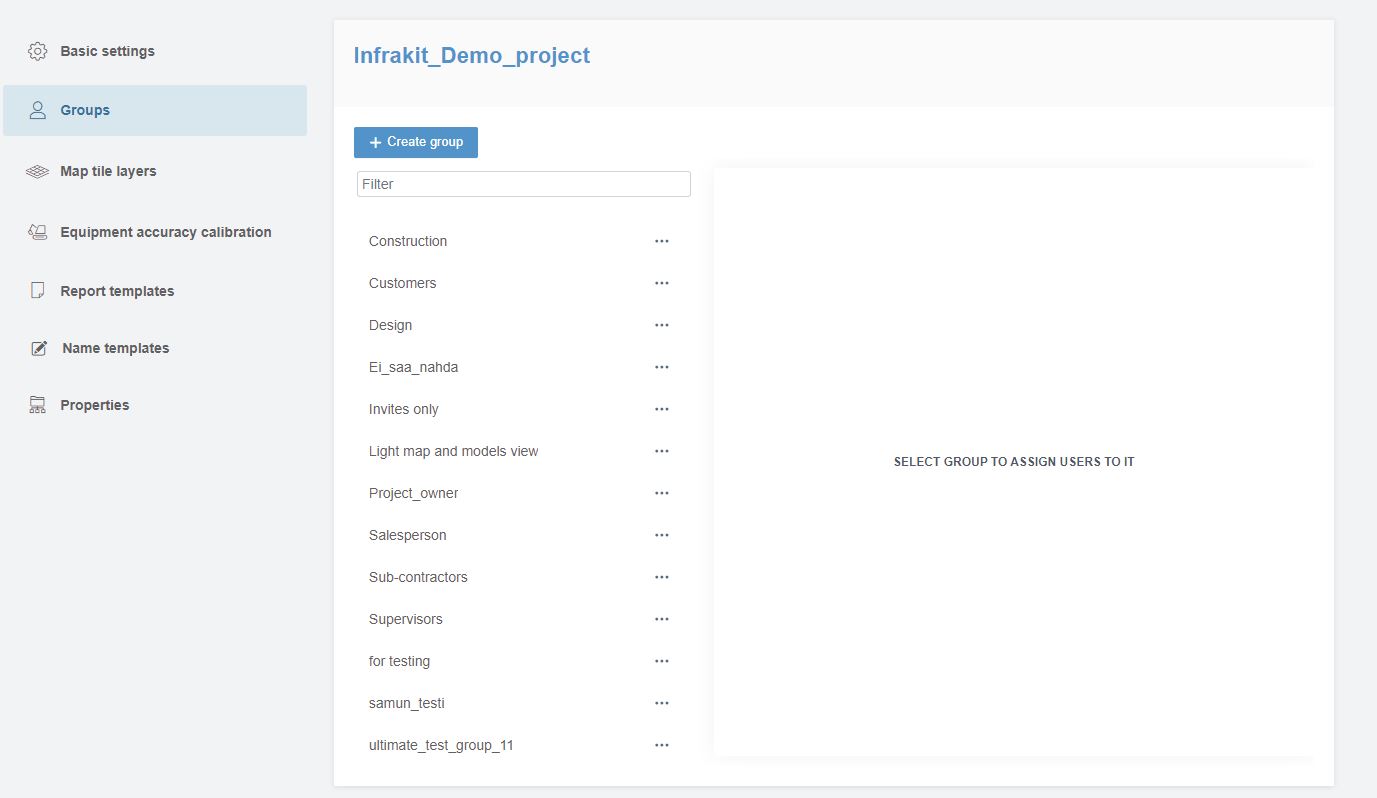
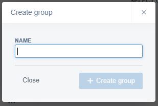
- To create a group select +Create group
- Name group
- Select group to assign users to it
- Save
Map tile layers
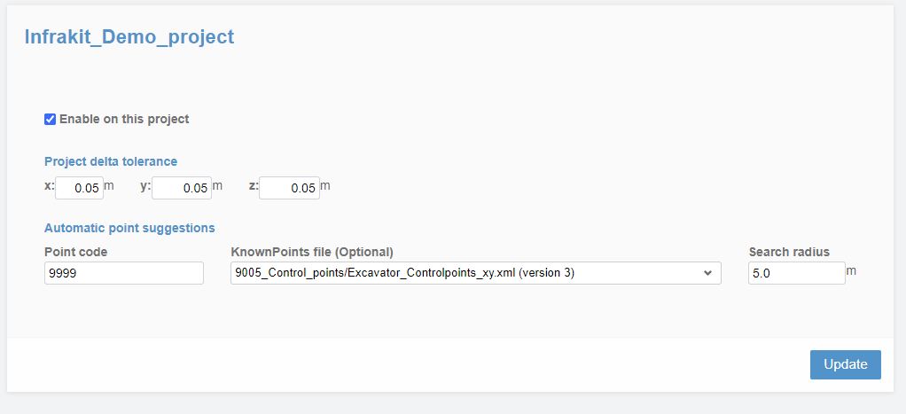
Equipment accuracy calibration
Here you can set up accuracy tracking for project equipment
- Project delta tolerance sets the allowed tolerance for vehicle accuracy tracking points
- Point code sets the point code that is used for accuracy tracking
- Known points file is the file that contains the check points
- Search radius limits the search distance between control point and vehicle accuracy point
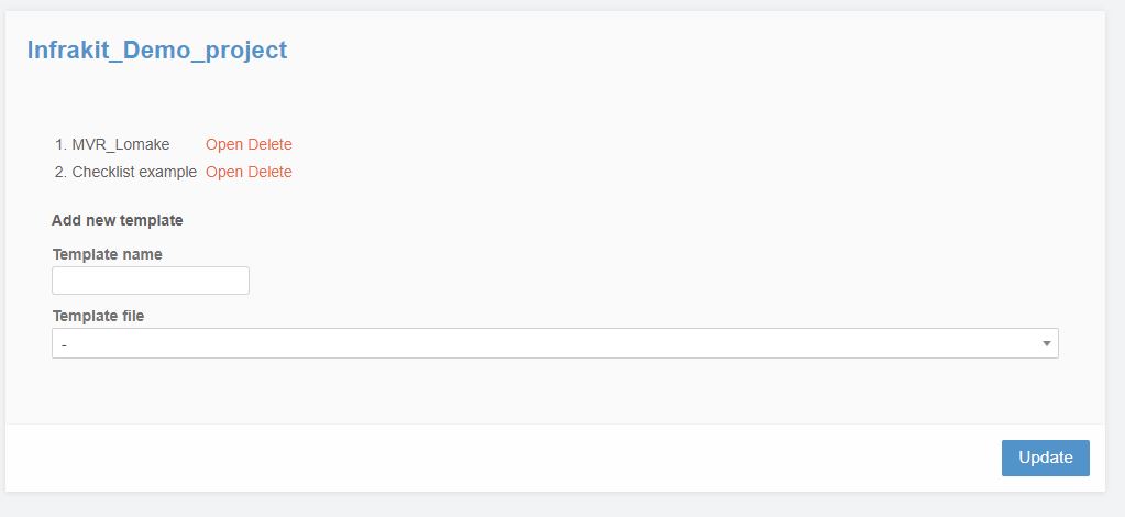
Report templates
Here you can select pdf report templates that Infrakit Field app uses
- Name template
- Locate the template file from project folder structure
- Update
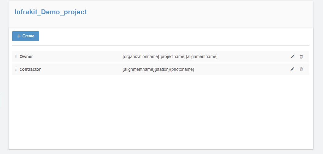
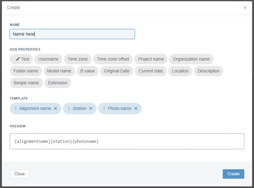
Name templates
Name templates are used for photos taken with Infrakit FIELD app
Created template can be selected from the FIELD app
- Create new template from +Create
- Name template
- Add properties from the selector by clicking it
- You can change the order of the items by dragging them
- Template and preview is shown
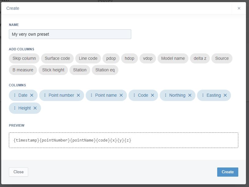
As-built presets
As-built presets are used for importing and exporting of the as-built points
With a preset you can define most commonly used as-built formats and there is no need in every import and export to select the order of the columns
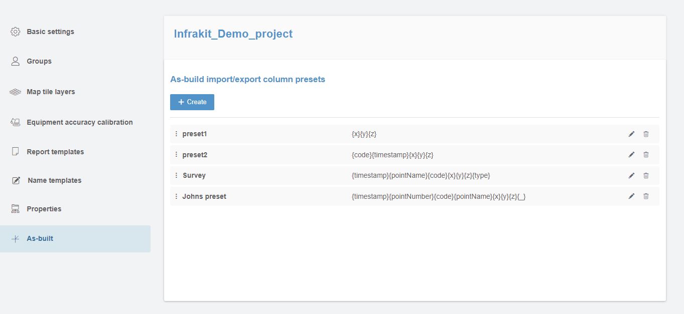
To create a preset:
- Click +Create
- Name your preset
- Select columns and the order of the columns
- You can edit the order by dragging the items
- Preview of the preset is shown at the bottom of the window