
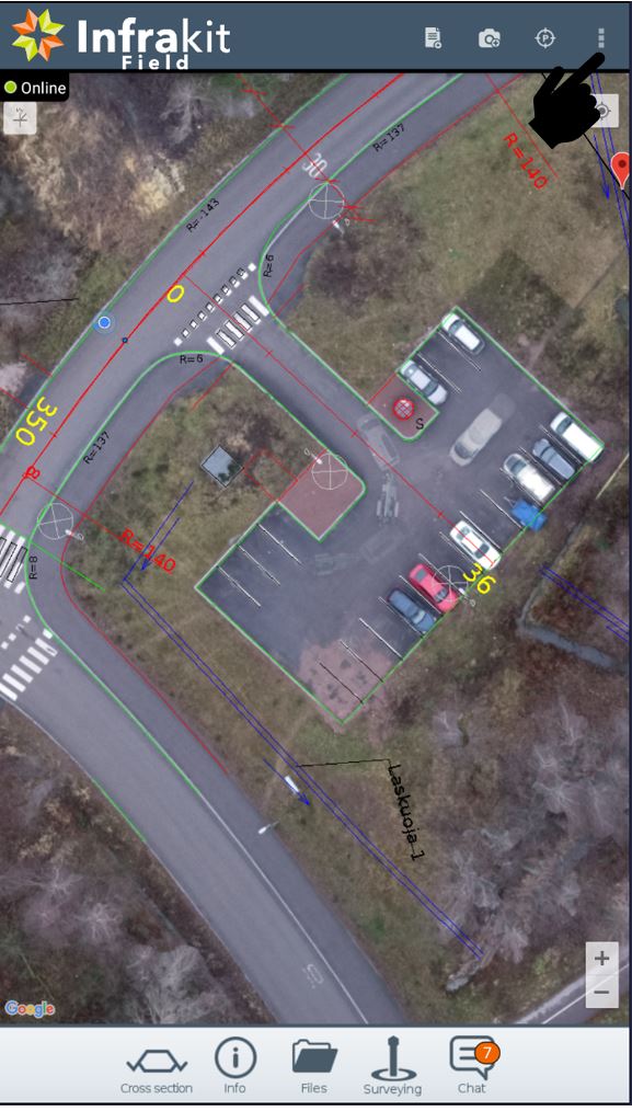
- Kebab-menu can be found here
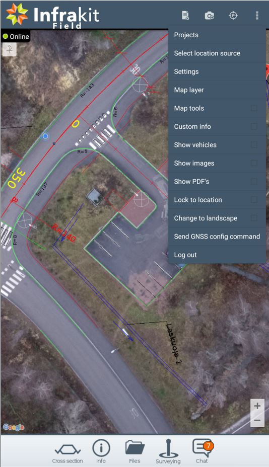
- From kebab-menu you can select
- Used project
- Location source
- Go to settings
- App settings
- Settings for some pre-defined GNSS rovers
- Select map layer
- Google map layers
- Custom map layers
- Orthophotos
- WMS maps if those are present in project
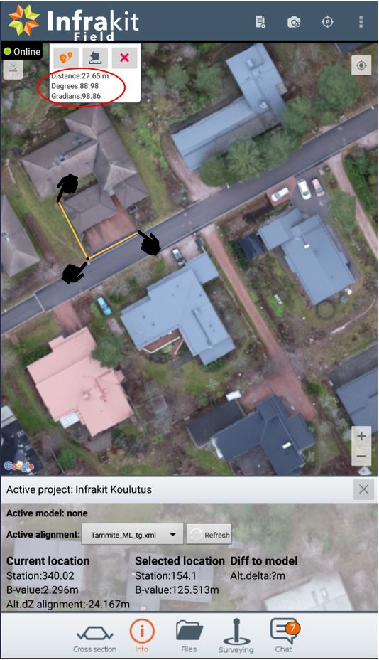
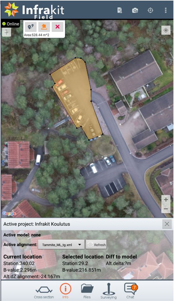
- Map tools
- Distance
- Area •Custom info
- Station
- B-value
- Model alt.delta
- User N&E
- User Z
- Pdop
- Pos. type
- Satellites
- Km stations
- alignment. alt. delta
- Show vehicles on map
- Show pictures on map
- Show PDF´s on map
- Lock screen to location
- Screen moves while you move on map
- Change display orientation
- Vertical •Horizontal
- Send GNSS configuration commands
-
Log out from the account
Location source
- Here you select what is used as a source for coordinates
- Internal
- Devices own GPS receiver
- Bluetooth
- Connect to external GNSS rover via Bluetooth
- Note: Bluetooth NMEA string does not contain data about accuracy
- Connect to external GNSS rover via Bluetooth
- Wifi
- Connect to external GNSS rover via wifi
- Different pre-defined location sources
- Note: some may require 3rd party app to work
- Internal
Settings
- App settings
- Enter stick height
- Enter GPS antenna offset
- Coordinate system altitude offset
- Minimum fix accuracy for log point
- This defines what accuracy must be when taking log points
- Show location in WGS84 coordinates
- Disable log point confirmation
- Disable location stale check
- Disable fresh location check
- Used for taking pictures when location is not available
- Use alternative icon when in RTK fix mode
- Wifi NMEA server addres
- Infrakit server
- Note: Some of the settings contain info-button next to them that describe function in question

Map tools
- From Map tools you can
- Measure distances and angles
- Select measure tool
- Tap the point where you want to start measuring
- Tap the poin where you want to measure
- Measure areas
- Measure distances and angles

Distance and angles
- App will show you measured line in yellow
- Distance along the measured points is show in info
- Note: if multiple measuring points are taken app will show you always the latest corner
Area
- Select area tool
- Tap the points where you want the area to be calculated
- Area will show in the info
- Note: you need atleast 3 points to calculate area
- Zooming in helps you to have more accurate results
- ❌ clears the selection
Custom Info
- Select Custom info from the kebab menu
- Press wrench icon to select which values you want to display
- Press wrench icon to select which values you want to display
