
Managing folders

Tip: Files and entire directories (in zip-file) can be uploaded to Infrakit by dragging it to files page. If there is already file with identical name, Infrakit will make it a new version of it.
Managing files
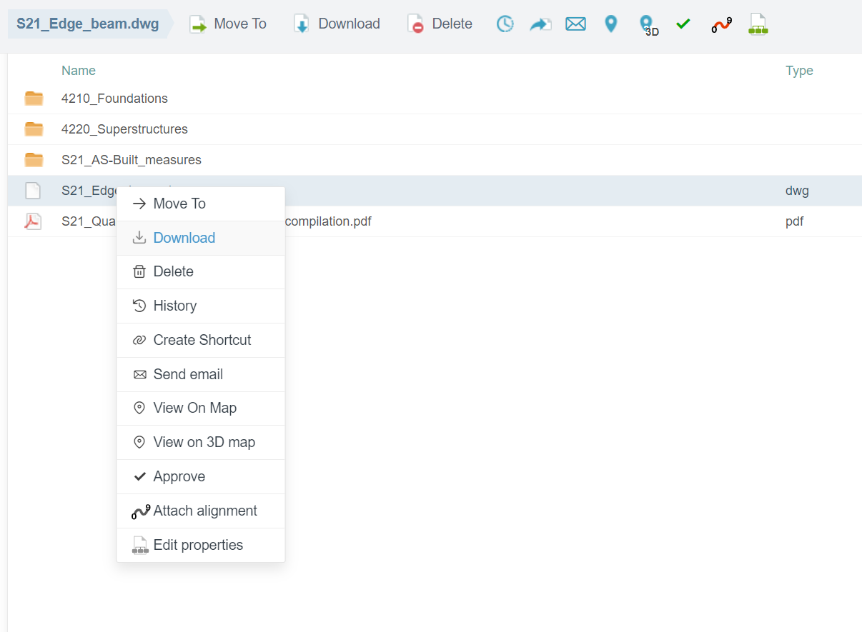
Tools to manage files can be found by right-clicking the file name or at the top of the page.
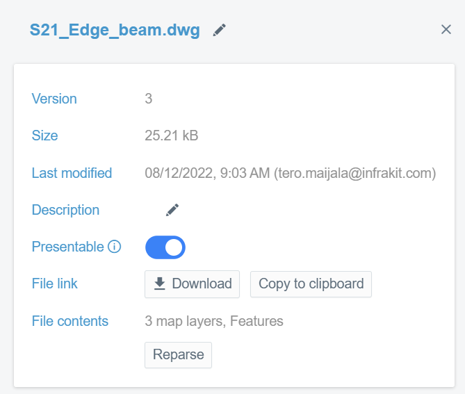
By clicking the name of the file it is possible to write description for the file, download the file, copy link to the file and reparse the file. With "Peresentable"-toggle you can select if the file is shown on the map page, visualization page and cross-sections or not.
Version history
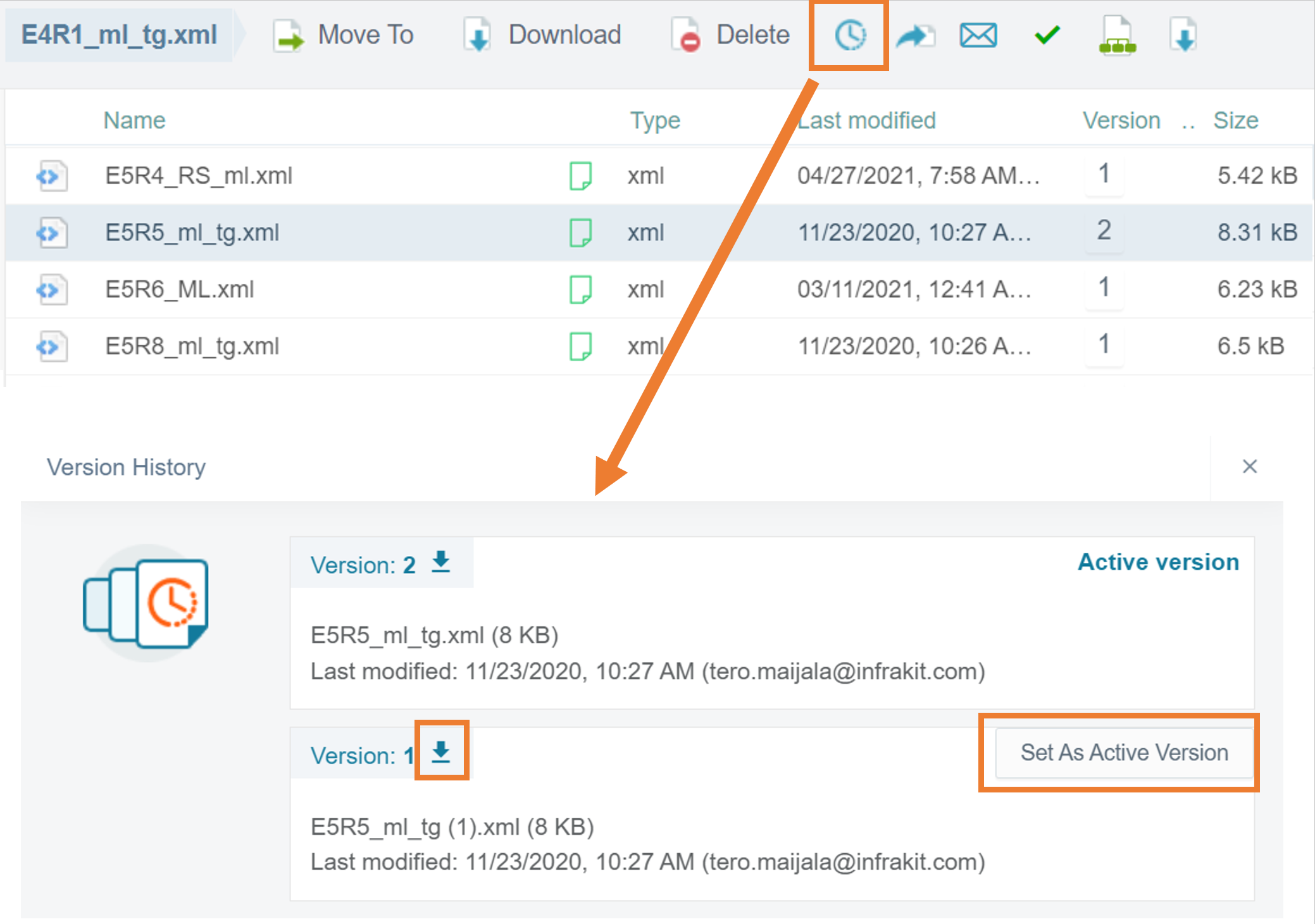
The version history is managed behind the clock icon. First click the line of the file and it turns gray, then click on the clock icon and see the version history.
File types
Infrakit uses open file formats. If you need a new file format to be supported, please contact us (support@infrakit.com) and provide file specification and explanation how it will be used. It is likely that we can create support for all your important file types.
- Triangle mesh – File is a DXF or LandXML triangle mesh surface.
- IFC for structures (steel, concrete...)
- Pipe networks (LandXML)
- Line model – File is a LandXML/Inframodel line model. The file should contain one surface defined by alignments.
- Point files - CgPoints XML, gt or geo
- Map – DXF map file can contain lines, points, texts and other shapes
- Alignment – File is a LandXML alignment. The first alignment found in the file will be used. To draw perpendicular cross sections, user must have an alignment active. However, it is possible to draw free cross section without selecting an alignment.
- Document – .pdf, .xls or a Word document .doc file that shows on map
- Other – File will not be checked or drawn on map. However, it may be transferred into selected machine control system specified by the user.