Once opening the mobile app, you'll see the map interface with different buttons.
To visualize data on the map, you can select different types of information from the bottom tabs.
Starting from the left-hand side in order ->
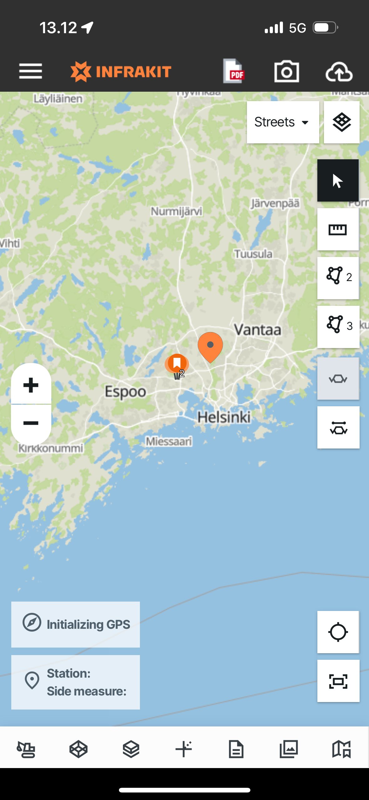
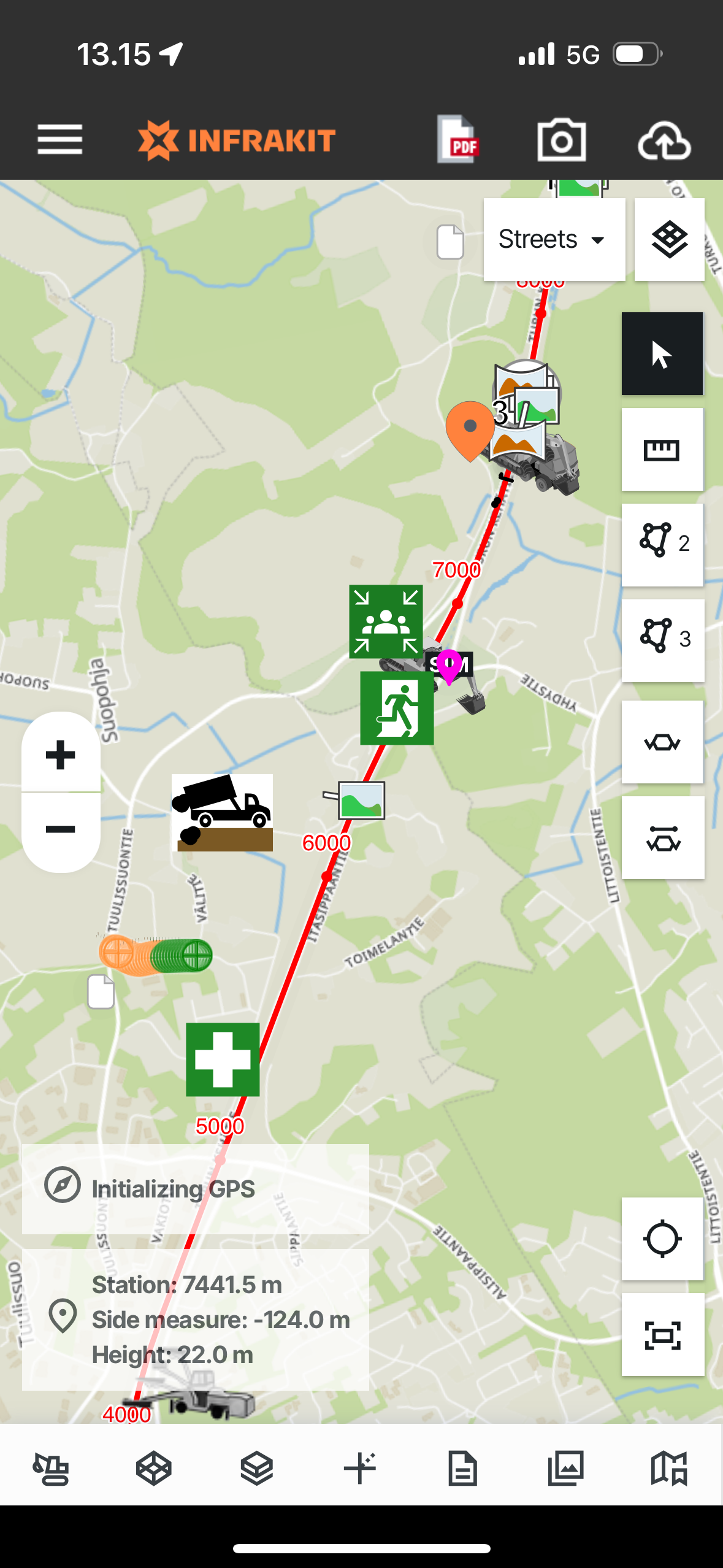
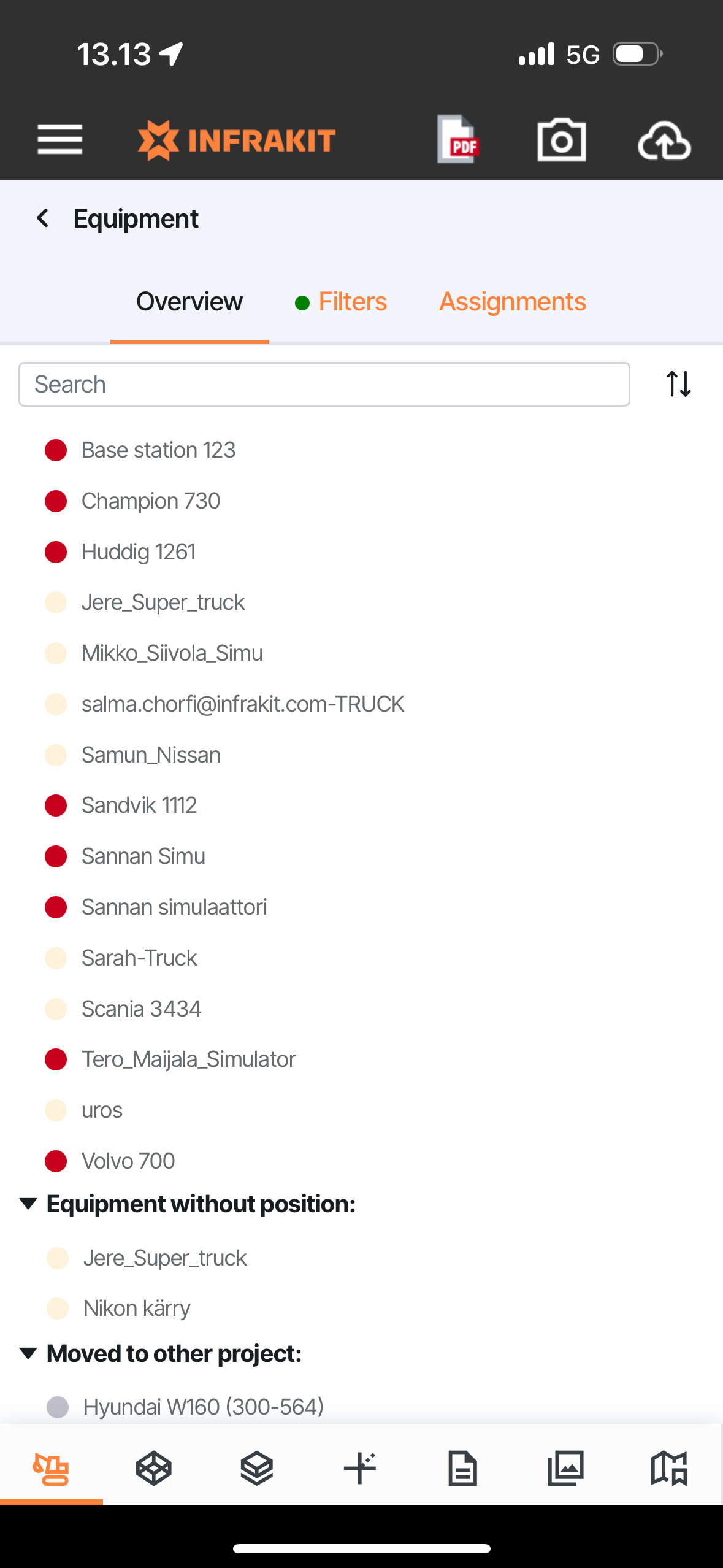
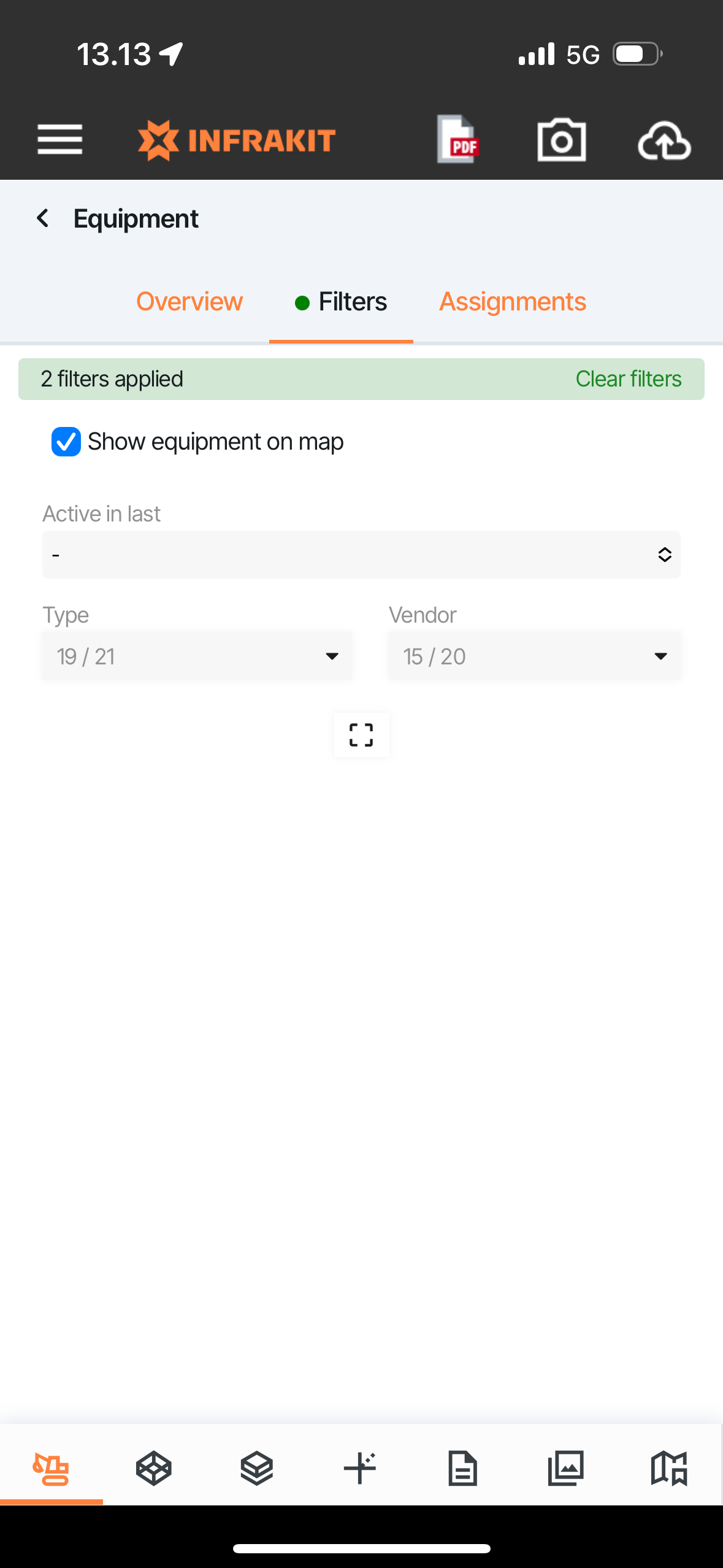
1. EQUIPMENT - You can see which equipment is operating on the site, where they are at, and what they are working on now / where they have been moving
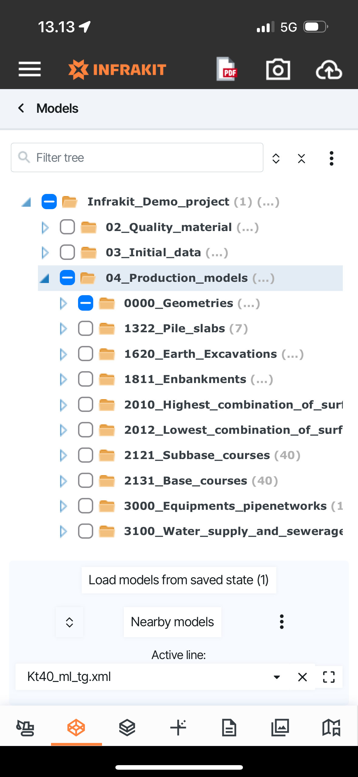
2. MODELS - You can select which models to see on the map - depending on your device RAM and other technical limitations of course (no. 1 Tip: Do visualize only necessary models at a time to prevent the application from crashing due to device limitations) - (no. 2 Tip: You can reload the models you had selected in the previous session by pressing here the button "Load models from saved state)
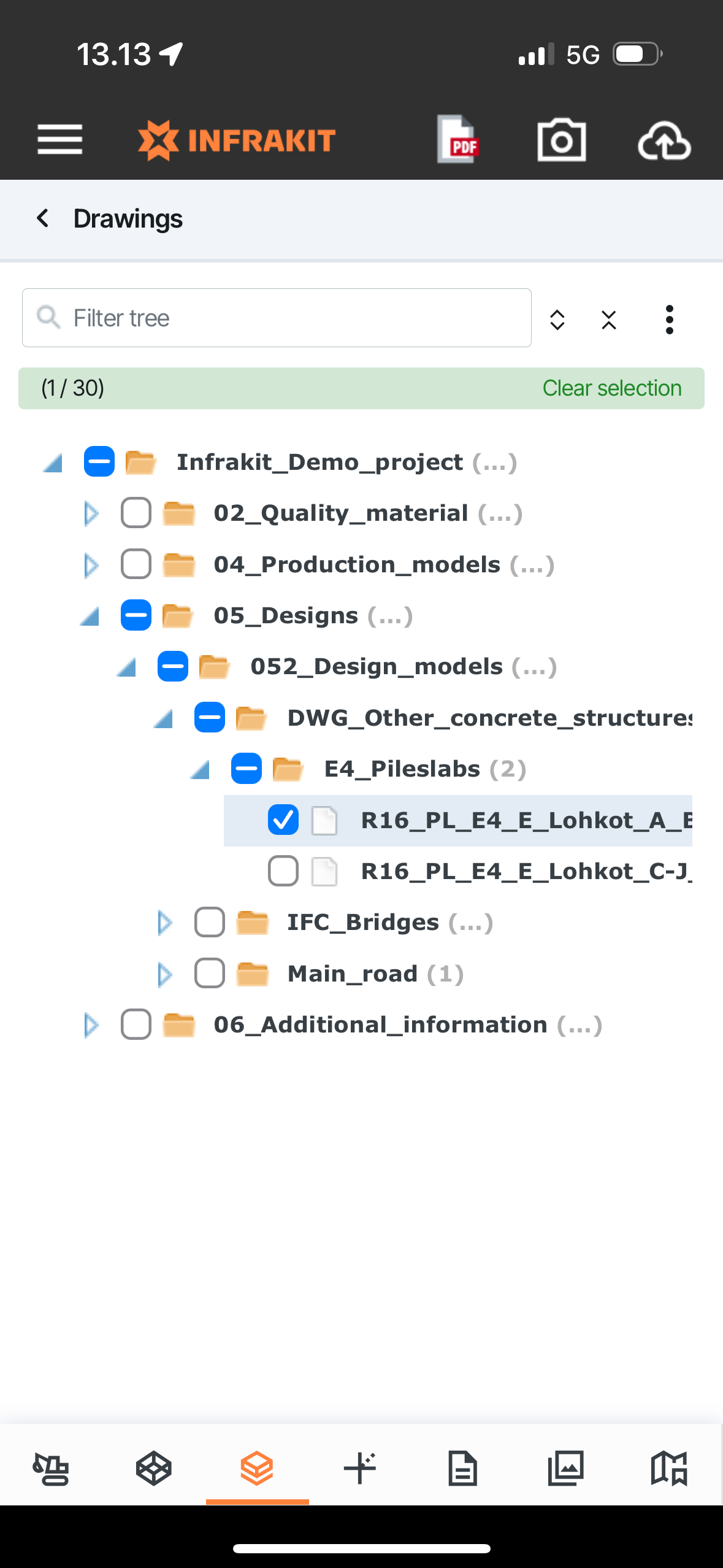
3. DRAWINGS - You can select which drawings to visualize on the map
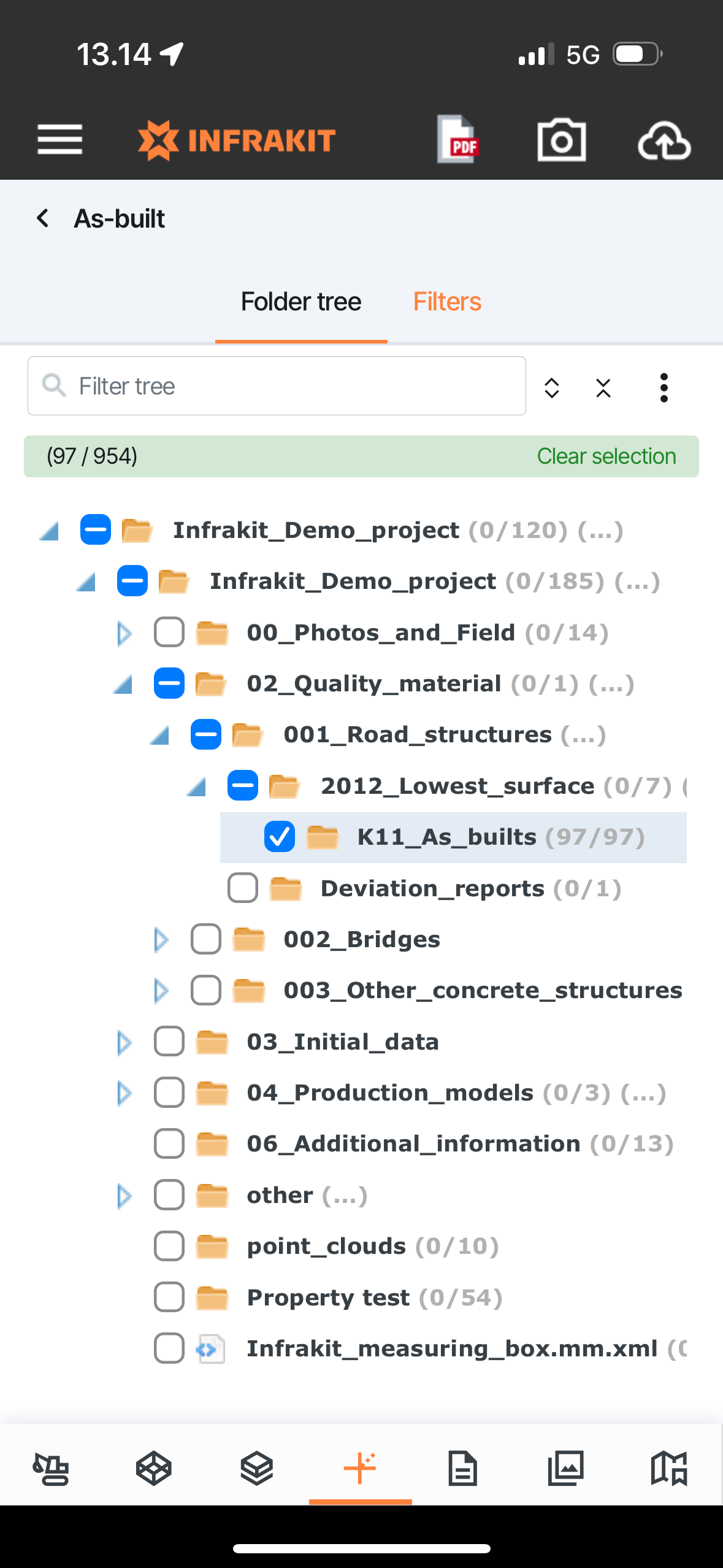
4. AS-BUILTS - You can select which as-built points to visualize on the map
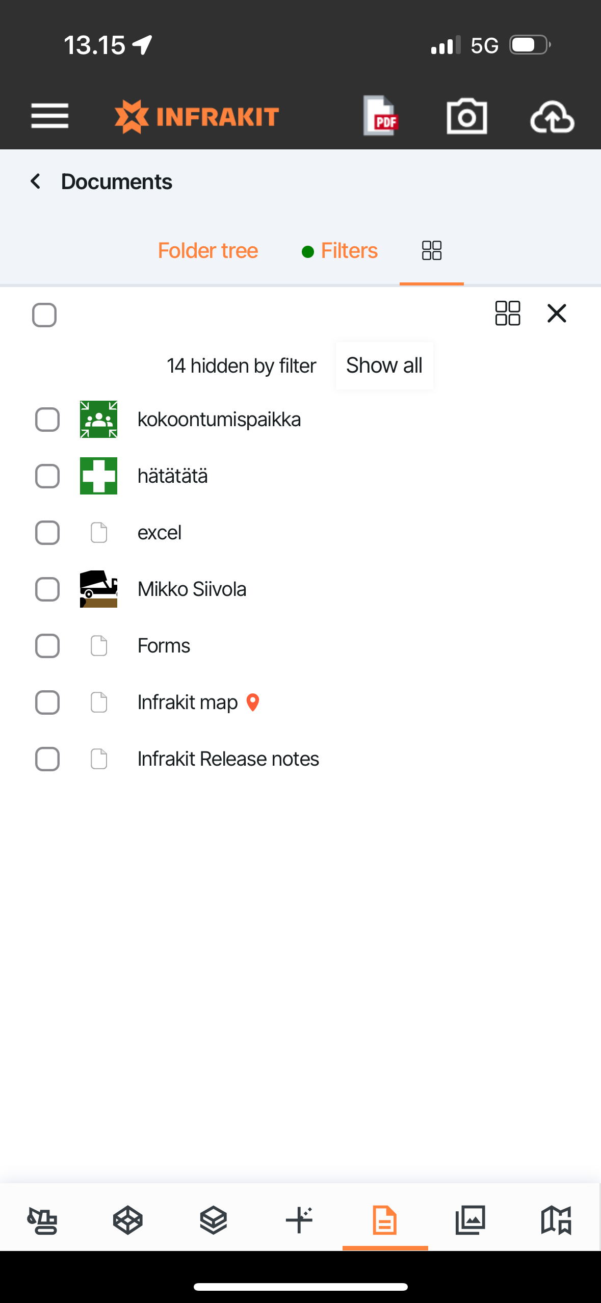
5. DOCUMENTS - You can see document positions on the map if they are attached to some location + view the documents
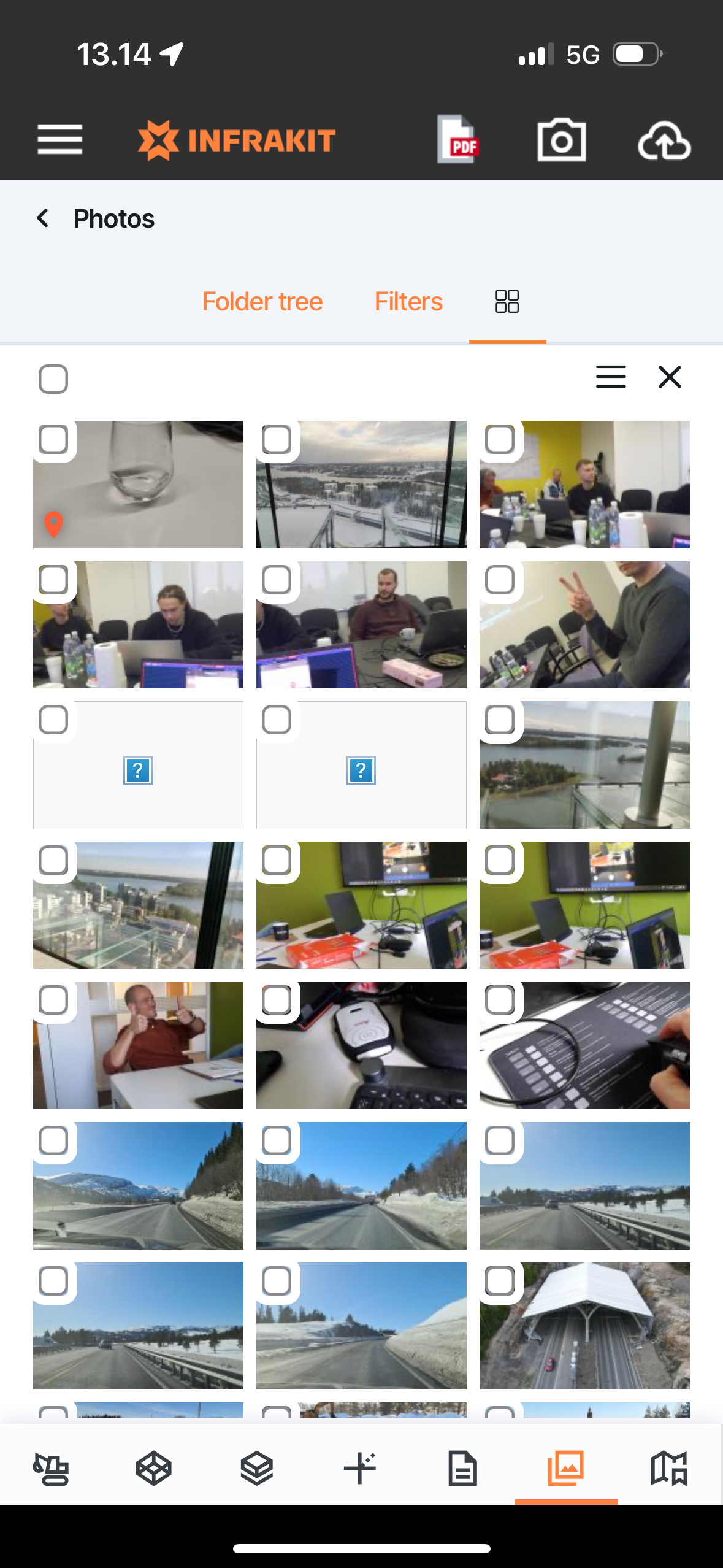
6. PHOTOS - You can select to see images with locations on the map and review them also within the tab
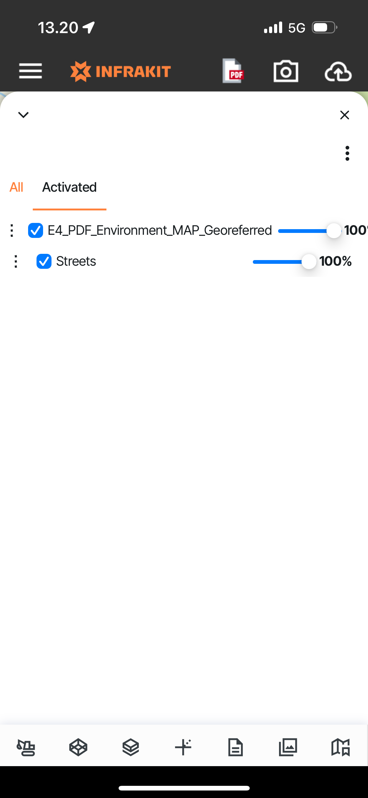
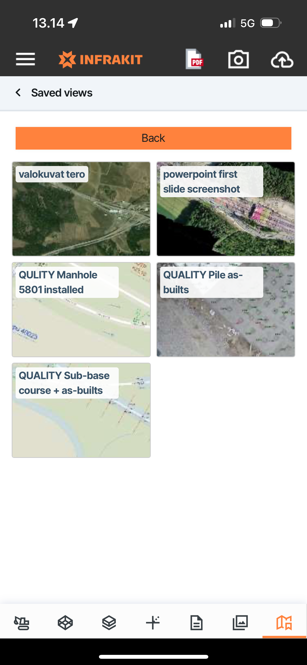
6. SAVED VIEWS - You can load premade states, which contain preselected data and information on the map - These views can be created and shared via Infrakit browser application OFFICE (Tip: You can also see the Saved View positions on map)
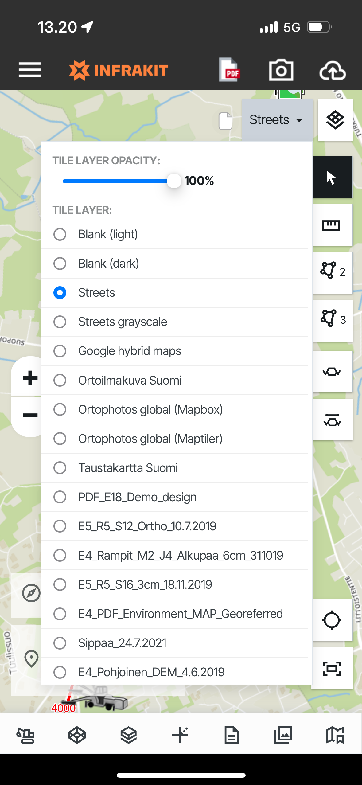
Alonside these tabs, you can select which background maps/map tiles to have on the map interface from the buttons on the right hand top corner ->