
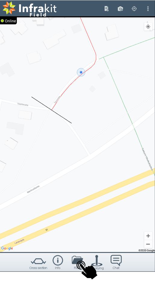
- Open Infrakit App
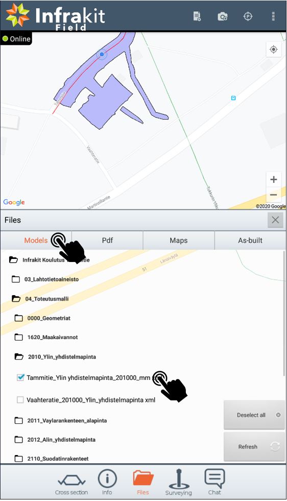
- Go to Files
-Select Models and design that you want to use
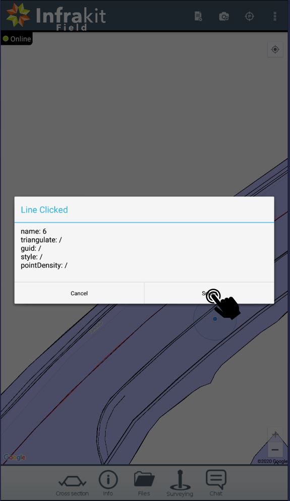
-In the map view, press and hold the design
-From the pop-up window, select Show model lines

-Select desired line by tabbing it
-And press Select
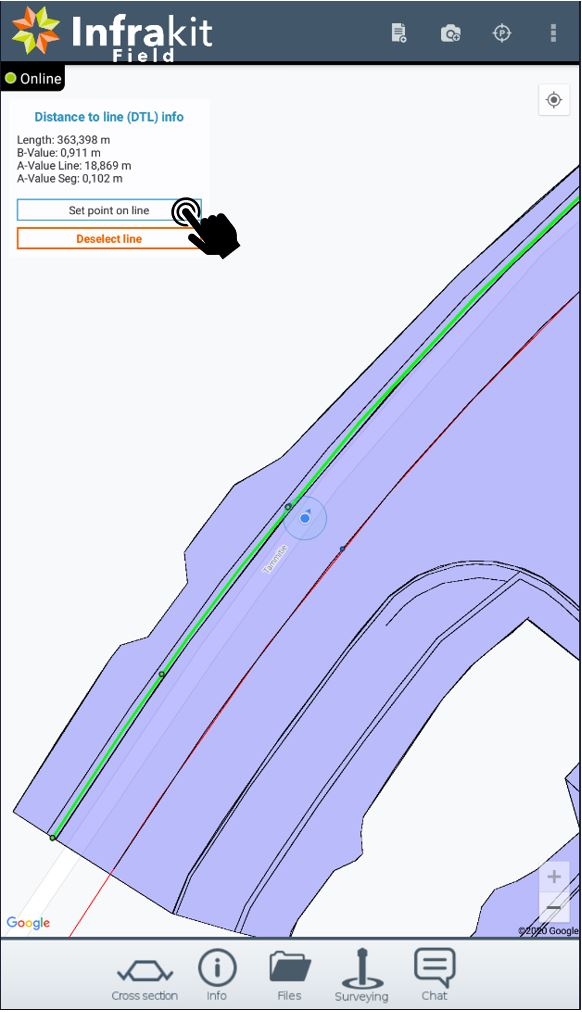
- Info box will show you the length, B-value, A-value of the line and A-value of the segment
- By default the nearest point on the line is calculated
- Small circle marks your location in the line
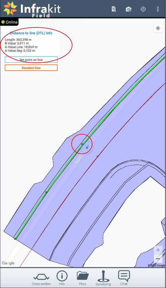
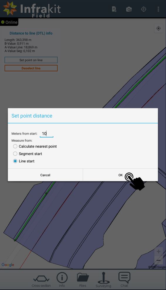
- Set point on line option gives you two more choices:
- To set the point X meters from the line start
- or from the segment start
- Insert desired distance from the beginning of the line (or segment)
- Infrakit Field app will draw you a small blue dot on the line with the attributes that you have inserted
- In this case 10m from the beginning of the line
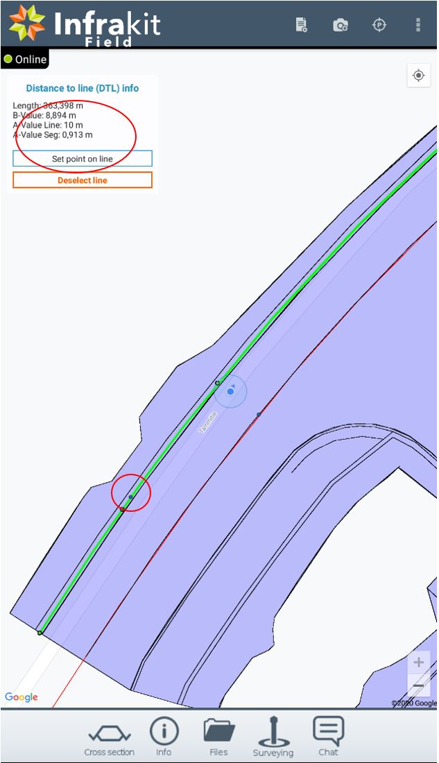
note: This function estimates the point on the line with +-10mm precision